
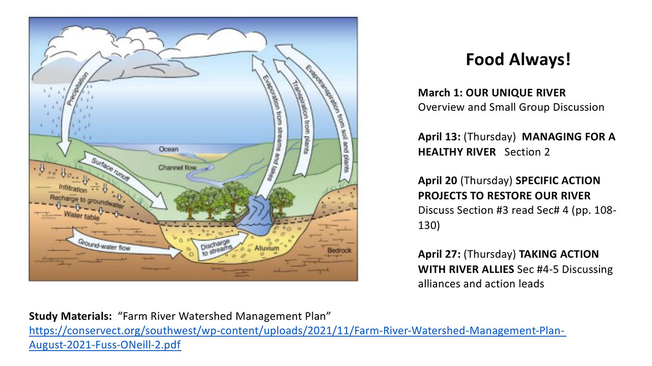
Left diagram shows the water cycle that affects our Farm River. 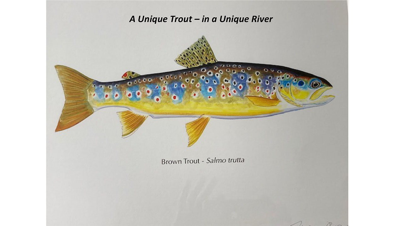
This brown trout sub-species was introduced to the Farm River by a fishing club of Yale professors who gained fishing rights to the upper Farm River soon after the Civil War. It has naturalized, and thrived in the relatively slow, muddy waters of the Farm River. A gorgeous fish, this painting was completed by James Prosek, a world renowned painter of the most interesting fish around the globe. 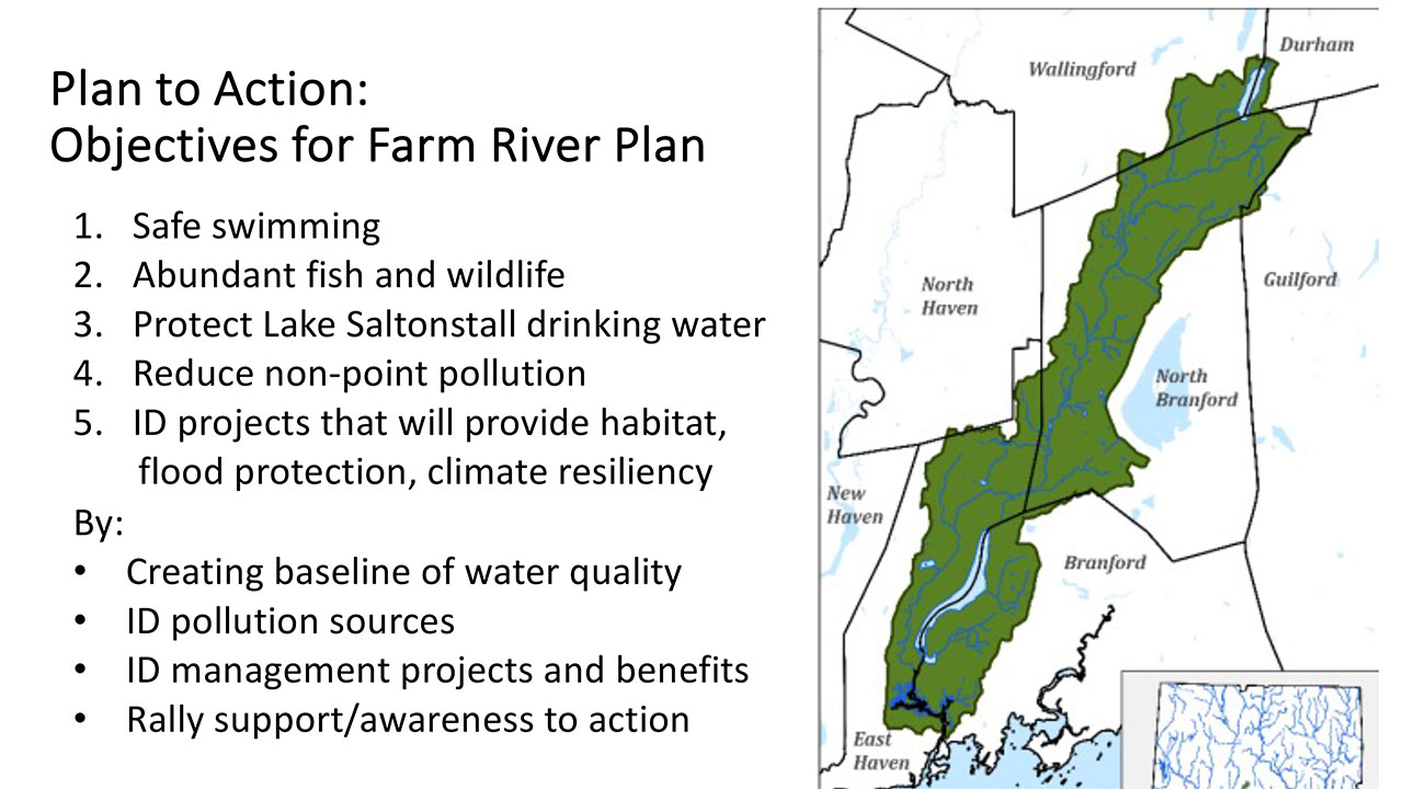
Every drop of rain that falls within the green boundaries of the Farm River Watershed eventually drains into the River and down into the Sound. The Watershed Plan is a roadmap to recovery. 
Volunteers from the Friends of the Farm River Estuary have been collecting data on the ecological water health of the estuary portions of the Farm River for 5 years. They have been joined by over two dozen other groups, measuring water quality/ecological health in all of the light blue identified bays and harbors around the Sound. The left hand diagram shows the watershed of the entire Long Island Sound. Thus drops of water from the Canadian border in green eventually flow into Long Island Sound. 
The Farm River, (#10 on Save the Sound’s Report Card) shows substantial ecological issues – including low oxygen and excess nuisance seaweed/algae. 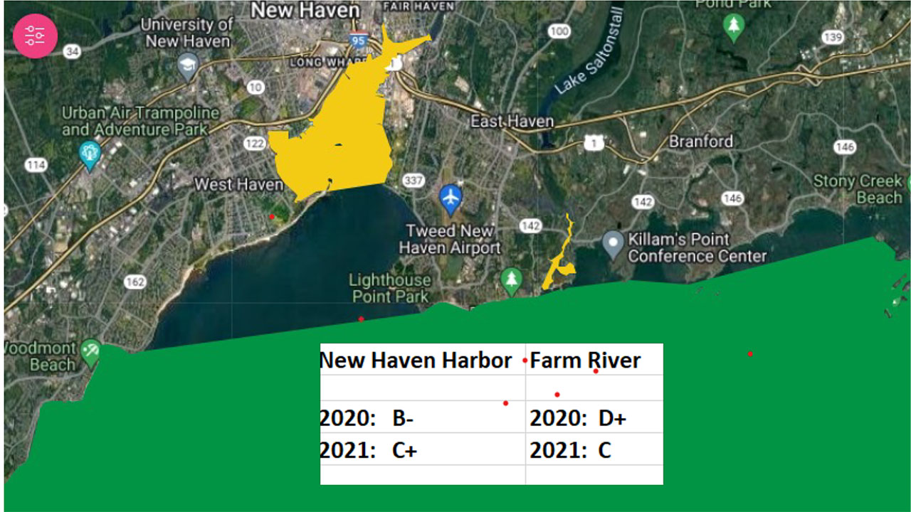
While New Haven Harbor has only been monitored using this system for two years; as you can see New Haven Harbor’s water quality has exceeded the water quality of the Farm River estuary. A cause of concern for the Farm River. 
The impacts of too much nitrogen pollution entering the Farm River evidences itself in excess algae and low oxygen conditions. 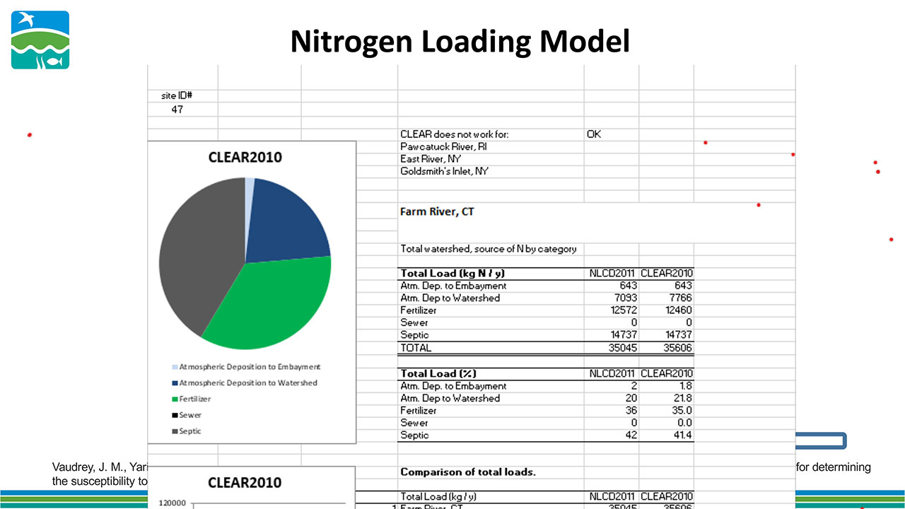
Sources of nitrogen, modeled by University of CT professor Jamie Vaudrey, suggests that septic and fertilizer runoff are the main causes of excess nitrogen. 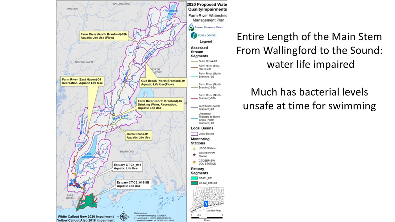
Virtually the entire length of the Farm River – from Wallingford down to the Sound – is impaired. Meaning the river is unsafe for our use (swimming) and unhealthy for fish and wildlife. 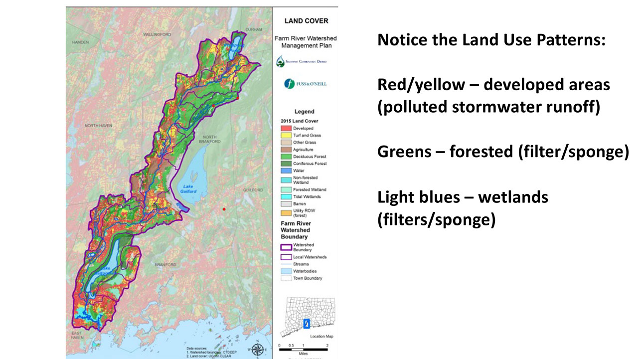
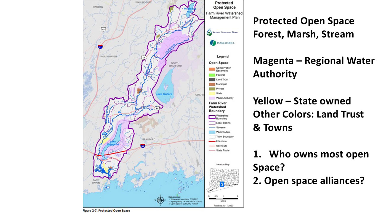
The Regional Water Authority is a critical conservation partner, as they own and manage thousands of acres of forest in the watershed. Two very large holdings are around Lake Saltonstall and the Gulf Brook sub-watershed in the northeast of the Farm River watershed. 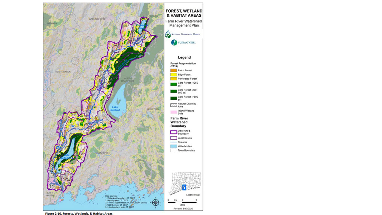
While the Regional Water Authority owns large core forests, there are many smaller forest edges and sections in yellow and light green. These create conservation opportunities. Note the large areas of wetlands around the southern, estuary area. 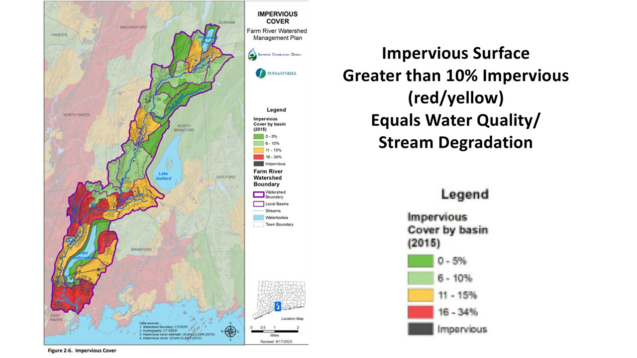
When streets, parking lots, driveways and roofs (impervious surfaces) make up more than 10% of a watershed area, they show up as orange or red. At 10 percent or greater, impervious surfaces degrade water quality. 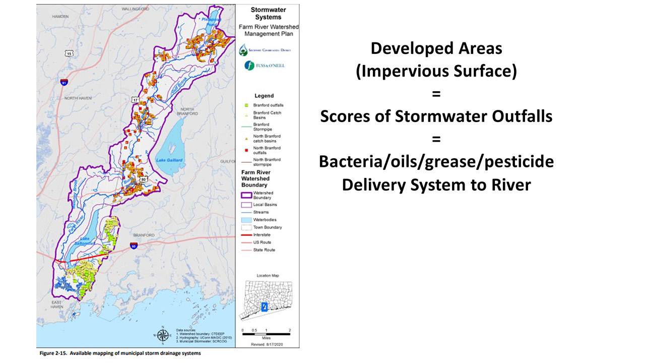
Impervious surfaces drain to stormwater basin/grates. These connect to stormwater pipes that whoosh polluted stormwater out to the Farm River’s creeks and main stem. There are hundreds of stormwater outfalls that dump polluted stormwater into the Farm River and its tributaries. Note that this image does not include East Haven’s stormwater outfalls. 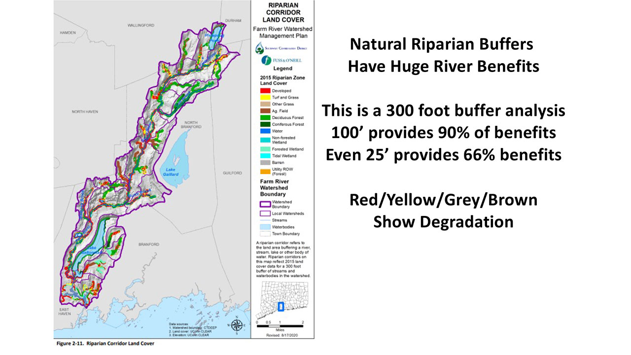
A natural, vegetated buffer along the Farm River or its tributaries has great benefits to the river. Lowering temperatures, providing fish habitat and cleaning the water. 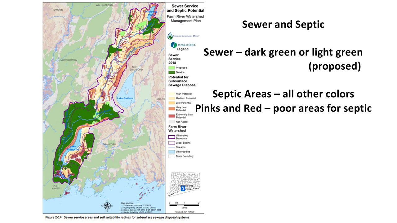
Sewers generally do a better job of protecting the Farm River’s water quality. Septics on small lots with lots of bedrock, are generally not effective in preventing sewage bacteria from polluting adjacent tributaries or main stem of the Farm River. 
-
Subscribe
Subscribed
Already have a WordPress.com account? Log in now.
